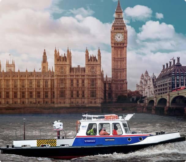
Westminster Bridge
Opened in 1862, Westminster Bridge has played a key role in the growth and development of London for over 150 years
Mobile Mapping | Westminster Bridge
Westminster Bridge is the oldest road structure which crosses the Thames in central London. A structure of such historical significance requires a great deal of resources to maintain, including topographical surveys.
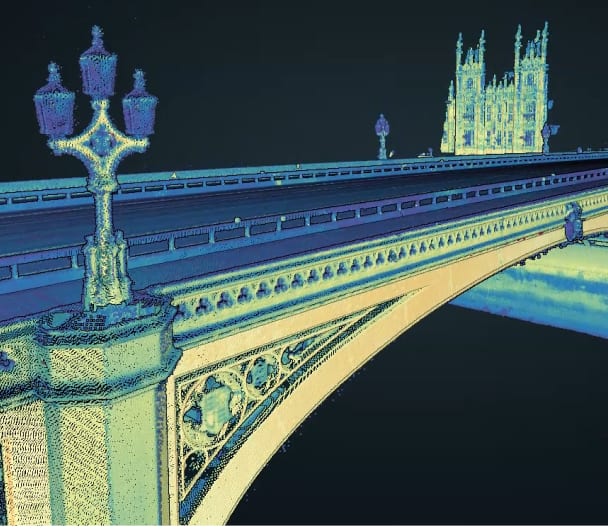
In 2022, Sun Hill was tasked to undertake a complete survey of Westminster Bridge. This required the combination of both vehicle and boat mounted scans, with the aim of producing a topographical survey for the top of the bridge, extracted elevations for the bridge faces, and the delivery of combined point clouds for the entirety of the bridge.
As one of the major river crossings in London, Westminster Bridge has a constant flow of traffic and pedestrians crossing on a daily basis, along with extensive river traffic travelling underneath it. This presented a challenge to survey the bridge whilst causing minimal disruption to day-to-day activities of the area.

To meet this challenge, Sun Hill utilised the multi-platform Leica Pegasus:Two mobile mapping system. The Leica Pegasus:Two uses a laser scanner in combination with GNSS receivers, an IMU and 360 cameras, enabling Sun Hill to acquire complete, accurate and precise spatial data.
In the boat configuration Sun Hill maintained survey-grade accuracy by using an additional antenna to counter the pitch and roll of the boat and collected all required data in a single site visit. Ground control on the bridge was used to accurately align the vehicle and boat mounted scans. Each bridge arch was scanned at multiple angles using the Pegasus system to provide a dense and complete combined point cloud.
Using this methodology, Sun Hill successfully captured 3D point clouds of the entirety of Westminster Bridge. From this, the requested datasets were extracted, and the point clouds themselves provided a permanent as built record of the bridge.
The use of the Pegasus:Two mobile mapping system allowed the survey to be undertaken without the disruption of road and underbridge closures, a key factor in a successfully survey in this key location in Central London. This methodology ensured that the survey was completed quickly, accurately and reduced the risk to the surveyors and the public, compared to traditional surveying methods.
The Pegasus:Two is completely vehicle-independent making it an excellent solution across multiple applications, whether it be road, rail or river. Sun Hill successfully utilised this flexibility of the system to capture all the required data using a single solution.
Westminster Bridge Video
Data Capture, Point Clouds, Analysis and Extraction
Related Services
Go to our Services Pages for the full range
Mobile Mapping - Car
A mobile mapping system is a vehicle mounted laser scanner which captures survey grade measurements over large distances while travelling at high speed
Read more
Mobile Mapping - Boat
A mobile mapping system is a vehicle mounted laser scanner which captures survey grade measurements over large distances while travelling at high speed
Read more
GIS Data Capture
As well as collecting the precise location of assets, Sun Hill can capture information about the asset
Read moreAccreditation and certification


