Confined Spaces
Our surveyors are qualified and experienced in working in confined spaces, such as underground tunnels and vent shafts
Professional Services
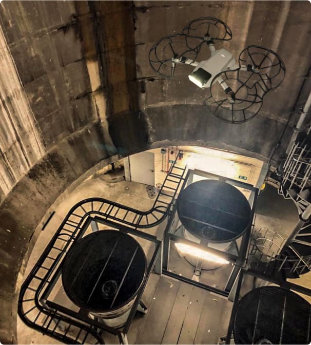
Sun Hill uses a range of surveying equipment to capture the required data in confined spaces, from laser scanners to drones
Civil Aviation Authority Accedited
Sun Hill’s experienced and qualified drone pilots maintain all the required insurances, Civil Aviation Authority permissions, RAMS and CSCS cards.
High Speed Data Collection
Our survey methods in confined space allow huge amounts of images and measurements to be captured at high speed. In a single site visit we can capture a permanent site record which can then be viewed and assessed from the safety of an office environment.
Reduced Risk
The ability to survey from a drone platform increases safety and reduces risk by minimising the requirement for physical inspections. The use of laser scanners also minimises the amount of time our surveyors spend in a confined space.
Multiple Output Options
Our outputs are specifically tailored to your needs and can range from traditional 3D CAD drawings to 3D point clouds, photographs and videos.
Sun Hill also provides online Web Services which enable point clouds to be viewed and analysed remotely through a web browser - Learn more
Case Study
Blackfriars Service Tunnel | London
Sun Hill was tasked to undertake a confined space survey of Blackfriars Service Tunnel using laser scanners.
This required all surveyors to be confined space trained and for extensive risk assessments to be in place to ensure the safety of everyone involved in the survey.
The aim of the surveys was to produce 3D topographical drawings of the service tunnel in relation to the ground above the tunnel.
This methodology provided a fast and safe method for surveying the tunnel while maintaining the high levels of accuracy required for the project.

Confined Space Laser Scanning
Related Services
Go to our Services Pages for the full range
Drone Inspections
State-of-the-art drone technology uses photogrammetry to produce highly accurate 3D models
Read more
Ground Penetrating Radar
PAS 128 compliant utility survey is a cost-effective risk management tool for mitigating both Health & Safety and financial risks
Read more
Thermal Analysis
Recording and measuring temperature variations allows us to easily locate problems which are otherwise invisible
Read moreFind out more about Confined Spaces
Accreditation and certification


